Climate, Environment & Biodiversity

These sectors focus on the study, conservation, and sustainable management of the Earth’s natural resources and ecosystems. They encompass a broad range of areas including climate change research, environmental protection, and biodiversity conservation. These areas are crucial for understanding and mitigating the impacts of human activities on the environment, such as pollution, deforestation, and species extinction. Efforts often involve cross-disciplinary approaches, combining science, policy, and community engagement to address complex ecological challenges and promote a balance between human needs and environmental stewardship.

Unlock Your Industry's Potential with Space - Schedule a Free Consultation Today!

Table of Contents

  • Renewable Energy: Transitioning from fossil fuels to renewable sources like solar, wind, and bioenergy.
  • Conservation Technologies: Using modern technologies for more effective monitoring and protection of wildlife and habitats.
  • Circular Economy: Promoting sustainable consumption patterns and waste management practices.
  •  

  • Global Warming: Addressing the causes and consequences of increasing global temperatures.
  • Habitat Loss: Tackling the loss of natural habitats due to urbanization and agriculture.
  • Pollution: Managing the impacts of air, water, and soil pollution on ecosystems and human health.

EO for Climate, Environment & Biodiversity

Earth Observation (EO), through the use of satellite imagery and remote sensing data, plays a crucial role in monitoring and managing our planet’s climate, environmental health, and biodiversity. By providing accurate, up-to-date information on the state of our planet, EO empowers policymakers, researchers, and conservationists to make informed decisions aimed at protecting and preserving our environment and biodiversity.

Biodiversity, Ecosystems, and Natural Capital

Species and Habitat Monitoring: EO technologies can map and monitor habitats, assess biodiversity richness, and track the health of ecosystems over time. This is crucial for conservation efforts, enabling the identification of endangered species and the impacts of human activities on natural habitats.


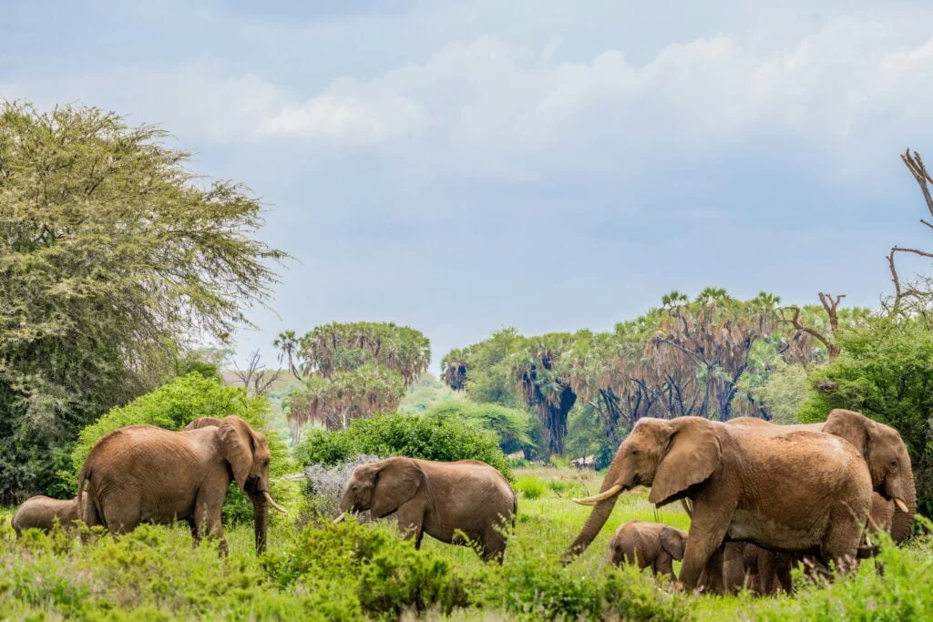
Ecosystems monitoring: Includes coastal, snow and ice, terrestrial and water ecosystems.


  • For coastal ecosystems monitoring, EO provides information on multiple parameters, such as coastal wetland loss, land-use cover and change, wetland mapping, coastal geomorphology, water optical properties, waterbody nutrients (chlorophyll-a), littoral and subtidal habitat, erosion and sedimentation mapping, long time series of ocean colour products including uncertainties estimates or health issues such as algal bloom detection.


  • For snow and ice ecosystems monitoring, EO provides data on snow and ice cover (multispectral and thermal, and to a lesser extent microwave), mapping the structural glaciology of big and small glaciers, mapping glacier change, conducting glacier inventories, mapping glacier thinning, measuring thinning ice shelves, glacier velocity, mapping glacier landforms and measuring the ice-sheet bed.


  • For terrestrial ecosystems monitoring, EO data provides information on plant species which respond differently to light emitted by the sun or by various artificial energy sources, with specific reflection characteristics in the electromagnetic spectrum. This makes EO data of adequate spectral and spatial resolution and a useful tool to distinguish different species. Other relevant data derived from EO relate to air/water quality completing the information for the status/forecasting of the ecosystem.


  • For water ecosystems monitoring, EO provides information on multiple parameters needed to assess the conditions and the equilibrium in water ecosystems, such as: bio-geochemical analyses and forecasts for global and regional seas, topography, bathymetry, ocean colour, sea-surface temperature, ocean currents, fish quantification, and others.


Ecosystem Services Valuation: By providing data on ecosystem changes, EO helps in evaluating the economic value of ecosystem services such as carbon storage, water purification, and pollination. This supports policy-making and conservation strategies aimed at preserving natural capital.


Integration by NGOs: Biodiversity and environmental NGOs are increasingly leveraging EO in their operations. For example, the World Wide Fund for Nature (WWF) developed the GLOBIL initiative, an online ArcGIS toolkit that consolidates geospatial data for ecosystem conservation, highlighting the growing importance of EO for biodiversity conservation.


Climate Services

Adaptation and Mitigation Strategies: Satellite data aids in the development and monitoring of climate adaptation and mitigation strategies. For example, it can help identify the most effective areas for reforestation or monitor the success of carbon sequestration projects.


Climate change mitigation and adaptation: Various types of EO data can be used to aid the formation of short and long-term climate change mitigation and adaptation strategies.


Climate monitoring and forecasting: Many types of EO data can be used in climate monitoring and forecasting. Air quality, land temperature, cloud cover and several other parameters relevant to the climate can all be understood with EO data, which in turn can be built into relevant models and contribute to climate forecasting. This information is vital for understanding climate change trends, modelling future scenarios, and informing global climate policy.


EO-based climate modelling: Many types of EO data, despite being unavailable for a long period, are used as an input into climate modelling. This results in computer-simulated dynamic projections of the Earth’s systems behaviour used for various purposes.


Environmental Monitoring

Environmental auditing: EO data aids in the assessment of the impact of human activity across four different environments: atmosphere, coasts, land, and water and oceans.


  • For the atmosphere, multiple EO satellites and sensors are dedicated to monitoring atmospheric conditions, including air quality and the presence of greenhouse gas (GHG) emissions, enabling the provision of short- and long-term forecasting.


  • For the coastal environment, relevant EO data can be acquired relating to wetland loss, land-use cover and change, wetland mapping, coastal geomorphology, water optical properties, waterbody nutrients (chlorophyll-a), and littoral and subtidal habitat.


  • With regards to land, relevant parameters range from land-use cover and change, vegetation, biomass, and soil monitoring, to the monitoring of human impacts, such as waste, constructions, and other infrastructure.


  • The relevant parameters for water and ocean environment which can be acquired through EO include temperature, transparency/turbidity, water depth, tides, currents, and to an extent, flora and fauna. The data also supports the monitoring of infrastructure and other traces of human activities, including waste.


Environmental impact assessment and ESG:  EO plays a vital role in conducting impact studies and implementing ESG policies across four distinct environments.


  • For the atmosphere, EO satellites and sensors are deployed to monitor atmospheric conditions, encompassing air quality and greenhouse gas emissions, facilitating both short- and long-term forecasting.


  • Along coastlines, EO data provides insights into wetland loss, land-use changes, wetland mapping, coastal geomorphology, and water properties, including chlorophyll-a levels and littoral and subtidal habitats.


  • On land, EO applications extend to land-use changes, vegetation, biomass, soil monitoring, and the assessment of human impacts like waste disposal,  construction, and infrastructure development.


  • In water and ocean environments, EO data captures parameters such as temperature, transparency, water depth, tides, and currents, while also offering insights into flora, fauna, and human activities, including the monitoring of infrastructure and waste.


Air Quality and Pollution: Satellites equipped with EO sensors monitor air quality indicators and track pollution sources worldwide. This data is essential for assessing health risks, enforcing environmental regulations, and developing strategies to reduce emissions.


Water Quality and Resources: EO technologies assess water quality in rivers, lakes, and oceans, including parameters like temperature, chlorophyll levels, and pollutants. They also monitor water resources, supporting sustainable water management practices in the face of climate change and population growth.


Disaster Response and Management: EO satellites provide critical information before, during, and after natural disasters, such as floods, hurricanes, and wildfires. This enables more effective emergency response, damage assessment, and recovery planning.


Ecosystem Conservation and Restoration: EO data’s increasing significance in ecosystem conservation and restoration projects is emphasized. This includes coral reef monitoring, where EO data offers insights into ocean acidification, 3D reef modelling, and health assessment, showcasing the critical role of EO in supporting large-scale environmental efforts.

GNSS for Climate, Environment & Biodiversity

By providing precise and reliable data, GNSS enhances our understanding of climate change, supports sustainable environmental management, and contributes to biodiversity conservation efforts, demonstrating the transformative potential of this technology in safeguarding our planet.

Climate Monitoring and Research

Sea Level Rise and Ocean Dynamics: GNSS technology is used to measure sea level changes and understand ocean dynamics. By equipping buoys and tide gauges with GNSS receivers, scientists can track sea level rise with high precision, which is crucial for predicting the impacts of climate change on coastal communities.


Glacier and Ice Sheet Movement: GNSS stations placed on glaciers and ice sheets monitor their movement and melting rates. This data is vital for understanding how climate change is affecting polar regions and for predicting future sea level rise.


GNSS-based climate modelling: GNSS supports a range of geodetic applications that measure properties of the Earth (magnetic field, atmosphere) with direct impact on the Earth’s climate.


Climate Change Mitigation: GNSS data supports climate change mitigation efforts by enabling the accurate measurement of land subsidence and carbon sequestration. This information is used in the development of green infrastructure projects, such as urban forests and green roofs, that contribute to carbon dioxide reduction.


Environmental Monitoring and Management

Forest Management and Deforestation: GNSS aids in mapping and monitoring forest resources, assessing deforestation rates, and implementing sustainable forest management practices. It provides accurate data for the enforcement of environmental regulations and for carbon stock assessments in REDD+ (Reducing Emissions from Deforestation and Forest Degradation) projects.


Water Resource Management: GNSS technology supports the management of water resources by enabling precise measurement of groundwater levels and the monitoring of irrigation systems. This helps in the sustainable allocation of water resources, especially in arid regions facing water scarcity.


Biodiversity Conservation

Wildlife Tracking and Conservation: GNSS collars and tags are used to track the movement of wildlife, providing insights into animal behaviour, migration patterns, and habitat use. This information is crucial for creating effective conservation strategies and protected areas that safeguard endangered species and biodiversity.


Habitat Mapping: GNSS technology enables the precise mapping of habitats, including wetlands, forests, and coral reefs. Accurate habitat maps are essential for biodiversity conservation efforts, allowing for targeted protection and restoration activities.

SatCom for Climate, Environment & Biodiversity

By enabling reliable, global communication and data transmission, SatCom supports the monitoring, protection, and sustainable management of our planet’s resources, contributing to resilience and conservation efforts worldwide.

Climate Monitoring and Adaptation

Global Climate Data Collection: SatCom facilitates the collection and transmission of climate-related data from remote weather stations, ocean buoys, and atmospheric sensors. This data is essential for climate modelling, research, and understanding global climate patterns.


Climate Adaptation Strategies: SatCom enables the dissemination of climate forecasts and adaptation advice to remote communities. By providing access to real-time weather information and early warnings for extreme weather events, communities can better prepare for and adapt to climate change impacts.


Environmental Monitoring and Protection

Pollution Monitoring: SatCom is critical for tracking pollution levels across the globe, including air quality, water contamination, and illegal dumping. It enables the rapid transmission of data from monitoring stations to environmental agencies for timely action and compliance with regulations.


Protected Area Surveillance: SatCom supports the surveillance of protected areas to prevent illegal activities such as poaching, logging, and mining. Drones and satellite imagery, combined with SatCom, allow for real-time monitoring and quick response by conservation teams.


Biodiversity Conservation

Wildlife Tracking and Research: SatCom enables the tracking of endangered species through satellite-enabled collars and tags, providing valuable data on animal migration patterns, habitat use, and threats to their survival. This information is crucial for the development of effective conservation strategies.


Habitat and Species Distribution Mapping: Through the use of high-resolution satellite imagery and communication technologies, scientists can map habitats and species distributions on a global scale. This aids in identifying critical areas for biodiversity conservation and understanding the impacts of environmental changes on different species.


Disaster Response and Risk Reduction

Early Warning Systems: SatCom plays a vital role in early warning systems for natural disasters such as hurricanes, floods, and wildfires. By ensuring uninterrupted communication, it enables the timely dissemination of warnings to at-risk populations and coordination among disaster response agencies.


Post-Disaster Assessment and Recovery: After a disaster, SatCom is essential for assessing damage, coordinating recovery efforts, and restoring environmental services. It provides a communication lifeline when terrestrial networks are down, facilitating effective response and aid delivery.

Innovative Applications

Advanced Sensing Technologies: Space-based lidar (Light Detection and Ranging) and radar technologies offer detailed 3D mapping of vegetation structure and biomass. This is crucial for assessing forest carbon stocks, monitoring deforestation, and supporting reforestation efforts. Lidar can penetrate forest canopies to measure ground-level vegetation, while radar is used for its ability to collect data regardless of cloud cover or lighting conditions, providing consistent monitoring capabilities.


CubeSats and Small Satellites


  • Hyper-local Climate Monitoring: Small satellites and CubeSats enable focused studies of microclimates and local environmental conditions. These smaller, cost-effective satellites can be deployed specifically to monitor urban heat islands, local air quality, and the health of specific ecosystems, providing data that supports targeted climate adaptation and mitigation strategies.


  • Biodiversity Monitoring Networks: Networks of CubeSats equipped with high-resolution cameras and sensors can create a continuous, global monitoring system for biodiversity. This can track changes in habitats, migration patterns, and the emergence or disappearance of species in near real-time, offering unprecedented insights into biodiversity dynamics.


Artificial Intelligence and Machine Learning

  • Predictive Analytics for Climate Resilience: AI and machine learning algorithms can analyze vast amounts of space-based data to predict environmental changes and potential disaster events, such as forest fires, floods, and droughts. This predictive capability supports early warning systems and helps communities and ecosystems adapt to climate impacts.


  • Automated Biodiversity Assessment: AI algorithms can process images and data from satellites to automatically identify species, count animal populations, and assess habitat conditions. This automation significantly enhances the speed and scale at which biodiversity assessments can be conducted, supporting conservation efforts.


Space-based Solar Power (SBSP): SBSP is a developmental technology that harnesses solar energy in space, where solar irradiance is constant and unaffected by Earth’s atmospheric conditions or day-night cycle. It has the potential to provide a continuous, reliable source of clean energy, overcoming the intermittency issues associated with terrestrial solar and wind power. This technology could revolutionize energy supply, particularly for remote areas and during periods of natural disasters when traditional infrastructure is compromised. Moreover, SBSP aligns with climate resilience efforts by offering a sustainable energy solution that reduces dependency on fossil fuels and mitigates greenhouse gas emissions.

Unlock Your Industry's Potential with Space - Schedule a Free Consultation Today!